In the heart of the Potosí highlands, the sacred territory of Wirikuta, located in the municipality of Catorce, San Luis Potosí, represents one of the most complex, diverse, and culturally significant arid ecosystems on the planet. Its area—just over 140,000 hectares—may seem modest compared to the immensity of the Chihuahuan Desert, but its biological density is proportionally exceptional: 526 species of vascular plants and 96 species of birds have been documented here, amounting to approximately 17 percent of the flora and 30 percent of the avifauna known for the entire ecoregion (CONANP 2012; Granados-Sánchez et al. 2011; WWF 2023).
This space, beyond being an ecological refuge, is—since time immemorial—the sacred place where the world emerged from darkness for the first dawn. It is the university of Wixárika culture and the spiritual axis of the world, a point of equilibrium between life itself and the future dreamed of by the ancestors in the deep caves of the sea.
Para leer este artículo en español ir a Wirikuta: el límite invisible de la vida en el desierto
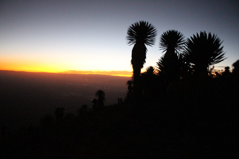
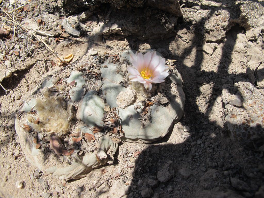
Photo: Tracy L. Barnett
However, the permanence of this wealth is being threatened by a silent but devastating process: the water crisis of the Vanegas-Catorce aquifer (code 2401). This underground system, which nourishes both human communities and the region’s biodiversity, is officially in a state of overexploitation, with a deficit of 7.9 million cubic meters per year (CONAGUA 2024). This means that each year more water is extracted than the system can naturally replenish, producing a net loss that accumulates and deepens over time.
Despite this diagnosis, on October 18, 2025, a citizen complaint was filed with the National Water Commission over the illegal drilling of a new well between Estación Catorce and Estación Wadley, within the limits of the Natural Protected Area and Sacred Natural Site of Wirikuta. According to CONAGUA’s own data, the project lacks a water concession and is tied to private interests linked to agro-industrial expansion in the area.
The degree of over-extraction already documented by CONAGUA is equivalent to more than 7.9 billion liters of water—enough to supply nearly 145,000 people for an entire year, the size of a city like Matehuala, or ten times the population of the municipality of Catorce. Ecologically speaking, that volume would sustain 150 natural wetlands or irrigate over 260 hectares of intensive crops, such as the greenhouse chili and tomato farms now proliferating across the high plateau.
A Fossil Water Crisis
The problem lies not only in excessive extraction but in the nature of the water being lost. The aquifers of the Potosí highlands store fossil water, trapped for thousands of years in geological formations that recharge extremely slowly. Extracting more than rainfall can replace means exhausting a hydrogeological inheritance accumulated over ages—a non-renewable resource on a human scale.
As wells are drilled ever deeper to compensate for scarcity, the system enters a process of hydraulic inversion: water from deeper layers—older and laden with salts and metals—rises toward levels used by people, leading to a progressive decline in quality. The result is a vicious cycle: every additional meter of drilling brings up saltier water, more expensive to extract and, in many cases, potentially hazardous to health due to arsenic, fluoride, and other heavy minerals (Villalobos & Jurado 2017).
This process marks not only the onset of an environmental crisis but also an ecological transition toward unsustainability, in which the natural balance that once sustained Wirikuta is breaking down. In a land where every cactus, bird, and seed depends on the underground pulse of water, the annual loss of millions of cubic meters translates into a structural weakening of the entire ecosystem.
What is vanishing is not only the water but also the desert’s capacity to sustain life. If the current trend continues, the Vanegas-Catorce aquifer could collapse entirely, unable to recover even if extraction were halted. The 7.9-million-cubic-meter deficit is not just another technical statistic: it marks the visible frontier between the desert’s resilience and its irreversible collapse—a warning that challenges not only authorities and scientists but all of society that depends, directly or indirectly, on water Wirikuta can no longer provide.
Signs of Hydrogeological Collapse
In other words, what is unfolding in Wirikuta is a hydrogeological collapse with grave environmental and public-health implications. In several highland communities, water drawn from wells shows increasing salinity and, in some cases, thermal emissions rich in dissolved minerals (Villalobos & Jurado 2017). This suggests that, as groundwater levels fall, the upper aquifer is being replaced by deeper, hydrothermal waters rich in heavy metals such as arsenic, fluoride, and manganese—all of which pose serious health risks (CONAGUA 2024).
Technically, this results from an inversion of the hydraulic gradient: when more water is pumped out than the aquifer holds, the pressure in lower strata forces ancient, mineralized waters upward into human-use levels. Consequently, water quality degrades irreversibly, altering soil chemistry, reducing its retention capacity, and changing the dynamics of ecosystems dependent on residual moisture.
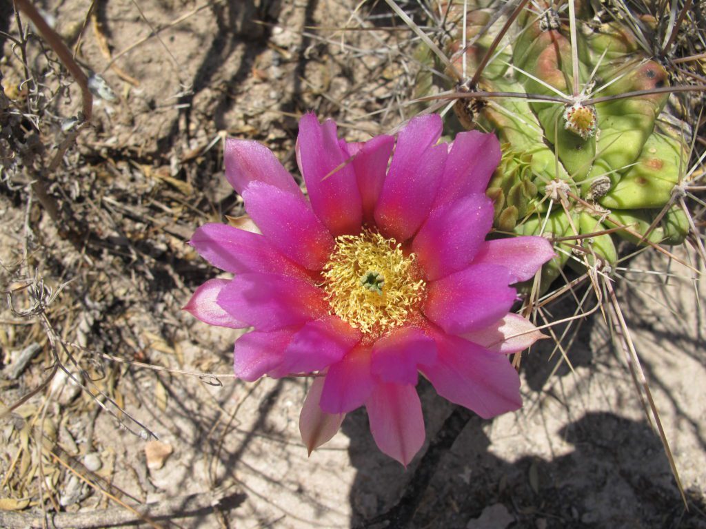
In Wirikuta, this degradation directly affects the cactus species that are emblematic of the region, whose physiology relies on delicate balances of moisture and salinity. Even minimal changes in the soil’s electrical conductivity can disrupt water absorption, causing wilting and death of endemic species that take decades to mature (Ermakova 2022).
Water, Agribusiness, and Territorial Conflict
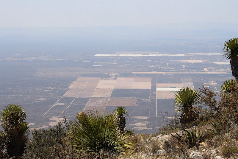
The overexploitation of the aquifer is closely tied to the region’s dominant economic model. Over the past two decades, the Potosí highlands have undergone an agro-industrial boom focused on intensive production of chili, tomato, and forage crops. Local estimates indicate that irrigating just 160 hectares of tomatoes consumes over 4 million cubic meters of water per year (El Proyecto Esperanza 2021).
To this we must add large-scale poultry and pig farms, which require even greater volumes of water and generate organic waste that contaminates soils and aquifers. This expansion has been made possible by lax regulations and weak environmental enforcement, allowing illegal wells to proliferate and uncontrolled water extraction to continue.
Water pressure is further compounded by territorial conflicts. In the locality of Wadley, residents have denounced a fraudulent land title attributed to Juan Coronado, allegedly to expand chili plantations. This attempted land grab not only threatens local families’ patrimony but reflects a disturbing trend: the use of fraudulent legal instruments to legitimize the hoarding of land and water in an already exhausted region.
In this context, the struggle for water is not merely ecological—it is a battle for territorial sovereignty and for the right to live with dignity in a deteriorating environment.
Community Resistance and Ecological Defense
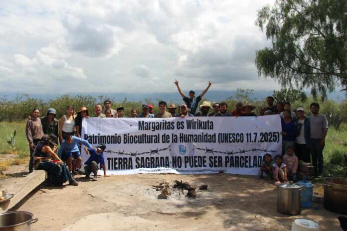
Amid this panorama of environmental decay and social tension, community-led actions demonstrate the possibility of ecological resistance. In the ejido Las Margaritas, residents undertook an action to remove barbed-wire fences from their communal lands—barriers imposed by outside actors seeking to promote agro-industrial and mining activity.
This measure not only safeguards the integrity of communal territory but also restores essential ecological processes such as wildlife mobility, seed dispersal, and the recovery of natural aquifer recharge zones—as well as access to sacred sites of the Wixárika people.
The “de-fencing” of Las Margaritas stands as a concrete example of how local communities, through organization and territorial knowledge, can exercise environmental conservation functions more effectively than governmental policies.
A Call for Reflection
The ecological outlook for Wirikuta demands deep reflection on scientific, political, and social levels. The observed signs of degradation—thermal wells, saline water, loss of endemic vegetation—are symptoms of a systemic imbalance that threatens the future viability of this ecosystem.
From the standpoint of conservation biology, Wirikuta can be considered an “ecological tipping point” within the Chihuahuan Desert: a site containing 18 percent of the desert’s flora and 30 percent of its bird species, now on the brink of losing the very hydrological foundation that makes its existence possible (Granados-Sánchez et al. 2011; WWF 2023).
The disappearance or degradation of this enclave would have global repercussions, for the Chihuahuan Desert harbors around 25 percent of all cactus species on Earth, many of which depend—directly or indirectly—on ecological processes occurring in Wirikuta (SEGAM 2024; Ermakova 2022).
If the current pace of extraction and land transformation continues, the system could face an irreversible functional collapse, marked by widespread soil salinization, desertification of biological corridors, and the extinction of species adapted to highly specific micro-habitats.
This makes Wirikuta a global indicator of the future of arid ecosystems—a mirror in which the depletion of water foretells the extinction of diversity.
The Shared Responsibility
The scientific community, governments, regional inhabitants, the Wixárika people, and national and international society now share an urgent, collective responsibility.
To protect Wirikuta is not only to preserve a landscape of great beauty or a cultural heritage—it is to safeguard a critical node of planetary ecological stability.
The limits of life in the desert are being tested; if those limits are crossed, what will be lost is not merely an ecosystem, but a millennia-old model of coexistence between humanity and nature.
References
- Comisión Nacional de Áreas Naturales Protegidas (CONANP). (2012). Preliminary Justification Study of the Sacred Natural Site of Wirikuta and the Historical-Cultural Route of the Wixárika People.
- Comisión Nacional del Agua (CONAGUA). (2024). Annual Update of Average Groundwater Availability: Vanegas-Catorce Aquifer (Code 2401).
- El Proyecto Esperanza. (2021, June 10). Water and Power in Wirikuta.
- Ermakova, A. O. (2022). Cultivation as a Conservation Tool for Cacti: Review of the Botanical Evidence and a Case Study of Lophophora williamsii. Cactus Conservation Institute.
- Granados-Sánchez, D., Sánchez-González, A., & Borja de la Rosa, A. (2011). Ecology of the Vegetation of the Chihuahuan Desert. Revista Chapingo, 17(esp.), 111–130.
- Secretaría de Ecología y Gestión Ambiental (SEGAM). (2024). Natural Protected Area “Wirikuta” and the Historical-Cultural Route of the Wixárika People. Government of San Luis Potosí.
- Villalobos, C., & Jurado, E. (2017). Hydrology and Vulnerability of Aquifers in Arid Zones of North-Central Mexico. Boletín de la Sociedad Geológica Mexicana, 69(3), 545–560.
- World Wide Fund for Nature (WWF). (2023). Chihuahuan Desert Ecoregion Profile.
✅ Translation by Tracy L. Barnett, 2025, from the original Spanish text published in Verde Bandera and is reposted here with permission from the author, Dr. Tunuari R. Chávez González.
- Wirikuta: The Invisible Limit of Life in the Desert - October 31, 2025